HIGH DEFINITION SURVEYING - 3D LASER SCANNING
Get clear results with our most comprehensive surveying solution.

The future of surveying is here:
Laser scanning, or LiDAR is the newest and fastest growing discipline in construction, architecture and land surveying. Whether it’s a building interior or exterior, roadway, bridge, tunnel or landscape, LiDAR allows for the most detailed and comprehensive record of field geometry. And that allows us to develop any number of drawings, plans, sections, 3D and 4D models or surface deviation maps of the field conditions, while maintaining the survey-grade accuracy our clients have come to rely on.
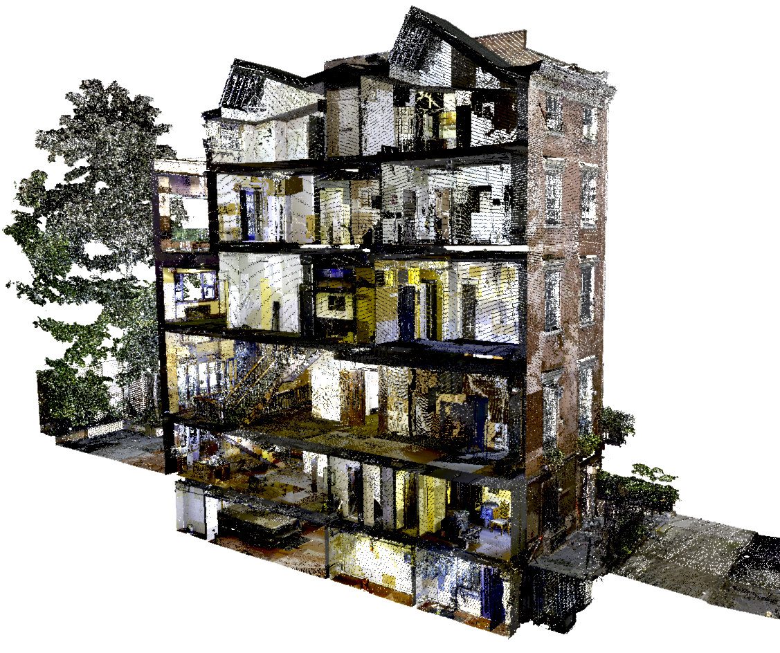
Our state-of-the-art scanners allow us to create complete and accurate models of your site called point clouds. From these point clouds we can extract measurements from all visible features.

Our expert team can precisely extract data along the section lines you specify and accurately draft changes in the floor levels and ceilings.

Due to the nature of laser scanning data, we can perform detailed of analysis of the site that are not available with conventional methods.

Laser scanning allows us to take the entire site back to our office for processing allowing us to extract measurements at any time without having to return to site.

Point clouds give our technicians unique perspectives on your project that are not available through conventional surveying methods.
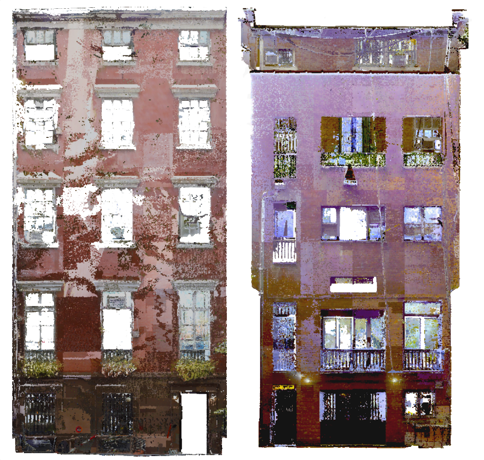
We can manipulate our models to view any part of the site in order to draft and verify dimensions.

Laser scanning works hand in hand with 3D BIM modeling, point clouds can be referenced into Revit to create and update features and families throughout all phases of the project.

Deliverables can be created to suit the exact needs of your project.

We use software such as AutoCAD and Revit to generate accurate and complete deliverables.
The process looks something like this:

We use a LiDAR crew alongside a conventional survey to collect point cloud data in the field. Data can be in assumed coordinate system or reference existing datum and plane such as, for example, NAVD88 and Manhattan borough coordinates

Next, we process the raw field-scan data, register (align) it, and check it in our office to produce a comprehensive point cloud

Finally, we use the point cloud to develop floor plans, drawings, sections and profiles, as well as models, meshes or other types of deliverables as requested


Why 3D HDS Is Right For You:
LiDAR service is our strength. It lets us bring an entire site back to our office where our expert extraction teams can provide you with accurate and complete solutions.
With our 3D HDS (or high-definition survey) laser scanning, we can create a point-cloud model of the entire project. And we deliver exhaustive results, often surpassing the original scope.
That Means:

Lower Costs

Comprehensive Results

Fewer Site Visits

Surveys You Can Trust
Our Leica instruments and software are the gold standard for the industry. They are capable of quick scans that are under 1 minute each, and accurate measurements at ranges of up to 1 kilometer away. Their dense point clouds of existing conditions allow our drafters and modelers to create the most accurate drawings and models. Our primary instruments are the Leica RTC360 and the Leica P50.

Most any project can benefit from the use of laser scanning:
Architectural interior and exterior surveys
Topographical surveysInfrastructure projects such as highway, bridge and tunnel among others
Railway surveys
Building façade surveys
Rooftop surveys
High precision structural measurements
3D and 4D Revit and other BIM projects
Surface deviation studies such as floor, ceiling and wall flatness maps
Calculating grades and volumes
We Make it Easy for You to Get the Job Done Right. On Time. On Budget.
We combine tried-and-true traditional solutions with the most up-to-date laser scanning technology to serve our clients with both efficiency and precision. Our field crews have years of experience in the NY Metropolitan real estate market, and they know how to quickly and efficiently set up a project for construction, boundary determination, scanning and delivery. We have a long record of taking on challenging, and sometimes out-of-the-ordinary jobs. It’s time to get clear results.